Check out Colorado’s 2025 accomplishments in the CRWUA 2025 Annual Report.
Here’s an excerpt:
Behind every water policy decision in the American West is one deceptively simple question: How much water is actually available?
In Colorado, that question has fueled conversation and conflict for over a century. Since European settlers first tried to make a living in this semi-arid state, measuring and managing water has driven innovation. Today, a complex legal and technical system guides water use from Denver to Durango.
As Colorado grew, the prior appropriation doctrine provided a legal backbone for managing water and supporting development. Technical advances enabled storage, transport, and measurement of water across rugged terrain and unpredictable conditions. Because annually variable snowpack makes up so much of the state’s water supply, snow telemetry (SNOTEL) sites were set up across many basins to give water managers key data on how much they might expect to end up in streams and reservoirs.
For decades, these sites have offered vital snapshots and long-term trends to guide policy and planning. But most SNOTEL stations sit below 11,000 feet and are sparse across Colorado’s vast landscape. In recent years, snowpack and streamflow patterns have grown more unpredictable, widening the gap between forecasts and actual water availability.
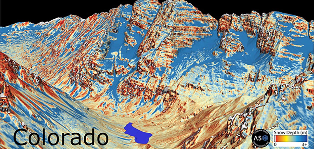
To improve our snowpack understanding, water managers have turned from the ground to the sky. Airborne Snow Observatories Inc. (ASO), building on a legacy with NASA’s Jet Propulsion Lab expertise, uses LiDAR-based technology to scan snowpack at a basin-wide scale from aircrafts, offering a detailed snapshot of the snowpack and how much water might be available each season.
In 2020, the Colorado Airborne Snowpack Measurement (CASM) Program was founded. It is a partnership of multiple local, state, and federal water partners committed to expanding access to state-of-the-art snowpack monitoring data to improve decision making across all water sectors. Agencies like Northern Water, Denver Water, the Colorado Water Conservation Board, and the Colorado River District have partnered with ASO to fly over high-altitude basins, helping build a clearer picture of Colorado’s water availability year to year.